On 27th May we issued a Press Release to local media as follows:
Developers Threaten Our Environment – Within Days!
The Local Development Plan recently adopted by Brentwood Borough Council has put valuable Green Belt Land under direct threat. Developers are already swooping in to capitalise on this. Residents in one area listed as being suitable for development have already had warning letters from developers.
These letters, possibly quite reasonably, ask them to remove any property from the green-belt land. They give a deadline of 31st May after which they will clear the land! This land is home to several badger families, nesting birds and bats; there is also a wide diversity of flora from the smallest wildflowers to large established trees. Some nearby gardens even report occasional Great Crested Newts visiting their fish ponds! This level of biodiversity takes decades to achieve and yet could be scraped away in just a few days’ time.
Why Does This Matter
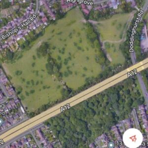
This ‘site’, actually two discrete sites straddling the A12, is listed for 200 homes but at what expense? The adjacent, already developed, area already has amongst the poorest air-quality in Brentwood. Removal of the green belt land will take away what is, effectively, a green lung. If developed this site will extend one of only a few Air Quality Management Areas recognised by the local Council*.
So, this new potential development area will suffer even higher levels of pollution than those experienced by current residents. This is tantamount to consigning many to an early death due to chronic health issues caused by air pollution; how many more death certificates are we to expect citing pollution as a contributory factor?
*Brentwood AQMA No. 4.
This seems to have prompted EssexLive (aka Gazette) to visit our website…
From which they published the following on 2nd June:
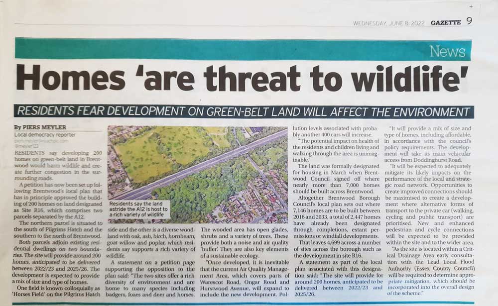
Residents claim new 200 homes near A12 on Brentwood green belt land will impact their health

Residents say developing 200 homes on green belt land in Brentwood would harm wildlife and create further congestion in the surrounding roads. A petition has now been set up following Brentwood’s local plan that has in principle approved the building of 200 homes on land designated as “Site R16” which actually comprises two parcels separated by the A12.
The northern parcel is situated to the south of Pilgrims Hatch and the southern parcel is to the north of Brentwood. Both parcels adjoin existing residential dwellings on two boundaries. The site will provide for around 200 homes, anticipated to be delivered between 2022/23 and 2025/26.
The development is expected to provide a mix of size and type of homes. One field is known colloquially as ‘Horses Field’ on the Pilgrims Hatch side and the other is a diverse woodland with Oak, Ash, Birch, Hornbeam, Goat Willow and Poplar which residents say supports a rich variety of wildlife.
A statement on a petition page supporting the opposition to the plan said: “The two sites offer a rich diversity of environment and are home to many species including badgers, foxes and deer and horses. The wooded area has open glades, shrubs and a variety of trees including Oak, Ash, Birch, Hornbeam, Goat Willow and Poplar. These provide both a noise and air quality ‘buffer’. They are also key elements of a sustainable ecology.
“Once developed, it is inevitable that the current Air Quality Management Area which covers parts of Warescot Road, Ongar Road and Hurstwood Avenue will expand to include the new development. Pollution levels associated with, probably, another 400 cars will increase. The potential impact on health of the residents and children living and walking through the area is unimaginable.”
The land was formally designated for housing in March when Brentwood Council signed off where nearly more than 7,000 homes should be built across Brentwood.
Altogether Brentwood Borough Council’s local plan sets out where 7,146 homes are to be built between 2016 and 2033 – a total of 2,447 homes have already been designated through completions, extant permissions or windfall developments. That leaves 4,699 across a number of sites across the borough such as the development in site R16.
A statement as part of the local plan associated with this designation said: “The site will provide for around 200 homes, anticipated to be delivered between 2022/23 and 2025/26. It will provide a mix of size and type of homes including affordable in accordance with the Council’s policy requirements. The development will take its main vehicular access from Doddinghurst Road.
It will be expected to adequately mitigate its likely impacts on the performance of the local and strategic road network. Opportunities to create improved connections should be maximised to create a development where alternative forms of transport to the private car (walking, cycling and public transport) are prioritised. New and enhanced pedestrian and cycle connections will be expected to be provided within the site and to the wider area.
As the site is located within a Critical Drainage Area early consultation with the Lead Local Flood Authority (Essex County Council) will be required to determine appropriate mitigation which should be incorporated into the overall design of the scheme.
In the Print Edition This Month
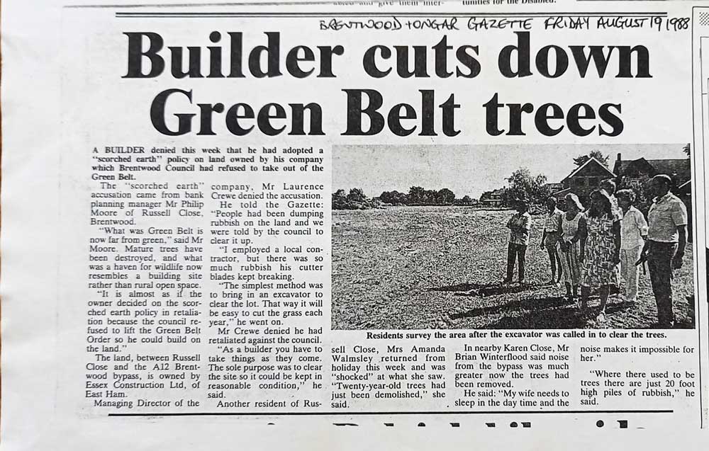
And over 30 years ago…